Whether you are a homeowner evaluating property risk, a roofing contractor assessing storm damage, or an insurance professional processing claims, hail reports by zip code are one of the most powerful tools at your disposal. Severe hailstorms can cause thousands of dollars in damage to roofs, vehicles, and landscaping in a matter of minutes. Understanding the hail history tied to your specific location gives you a measurable advantage when it comes to prevention, insurance negotiation, and property valuation. In this comprehensive guide, we will walk you through everything you need to know about accessing, interpreting, and leveraging hail reports filtered by zip code — from the basics to advanced strategies that even seasoned professionals rely on.

What Are Hail Reports by Zip Code?
A hail report by zip code is a localized dataset that documents hailstorm events — including date, hailstone size, wind speed, and damage severity — within a specific geographic area identified by its United States Postal Service zip code. These reports are compiled by organizations such as the National Weather Service (NWS), Storm Prediction Center (SPC), and third-party platforms like WeatherSTEM, AccuWeather, and ClaimRadar. The data typically includes hail diameter in inches, the type of storm (supercell vs. pulse), and whether the event was confirmed by radar or ground observations.
The value of zip code-level granularity cannot be overstated. A single metropolitan area can contain dozens of zip codes, each experiencing vastly different hail exposure depending on topography, elevation, and storm track patterns. When you search for hail reports by zip code, you are getting hyperlocal intelligence rather than a broad county-level summary that may obscure critical details about your exact neighborhood.
How to Access Reliable Hail Reports by Zip Code
Finding accurate hail data for your zip code has become remarkably straightforward thanks to digital platforms and public weather databases. Here are the most trusted methods:
- National Weather Service Storm Events Database — The NWS maintains a free, searchable archive of severe weather events by location. You can filter by state, county, and zip code to retrieve historical hail records.
- NOAA Storm Events — NOAA’s publicly accessible portal allows users to query hail occurrences using geographic coordinates or zip codes, returning detailed event logs with estimated hail size and property damage figures.
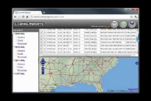
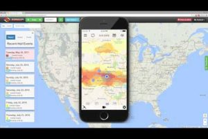
- Third-Party Hail Trackers — Platforms like HailStrike, WeatherFusion, and CoreLogic offer commercial-grade hail reports by zip code with visual radar overlays and damage assessments.
- Insurance Company Portals — Many insurers now provide policyholders with access to storm history reports by zip code through their online dashboards.
- Mobile Applications — Apps like MyRadar and Storm Shield push real-time hail alerts based on your zip code and maintain historical records.
Pro tip: always cross-reference at least two sources when researching hail reports by zip code. Radar estimates can overstate or underreport hailstone size, so having a confirmed ground observation or satellite verification adds credibility to your data.
Top Hail-Prone Zip Codes in the United States
While hailstorms can occur in virtually every state, certain regions experience dramatically higher frequencies. The Tornado Alley corridor stretching from Texas to Nebraska, as well as parts of the Front Range in Colorado, consistently rank as the most hail-prone areas in the nation. Below is a comparison of zip codes frequently cited in hail report databases:
| Zip Code | City | State | Avg. Hail Events/Year | Common Hail Size |
| 80202 | Denver | CO | 8–12 | 1.0–2.0 in |
| 78701 | Austin | TX | 10–15 | 0.75–2.5 in |
| 60601 | Chicago | IL | 5–8 | 0.5–1.0 in |
| 80301 | Boulder | CO | 6–10 | 1.0–1.75 in |
| 75201 | Dallas | TX | 9–14 | 0.75–2.0 in |
Keep in mind that these figures represent averages and can fluctuate significantly year over year. A single supercell thunderstorm in a high-risk zip code can produce more hail events than an entire calm season. Always check the most recent hail reports by zip code before making major decisions about property maintenance or insurance coverage.
Understanding Hail Report Data and Metrics
When you pull up a hail report by zip code, the raw data can seem overwhelming. Here is a breakdown of the key metrics you should focus on:
Hailstone Size Classification
- Pea-sized (0.25 in): Minor or no damage to most surfaces
- Mothball-sized (0.50 in): Cosmetic damage to vehicles; potential dents on soft metals
- Dime to penny-sized (0.75–1.0 in): Noticeable roof damage; bruising of asphalt shingles
- Quarter-sized (1.0 in): Significant roof impact; likely requires professional inspection
- Golf ball-sized (1.75 in) and above: Severe structural damage; emergency assessment recommended
Storm Classification Terms to Know
- Supercell: A rotating thunderstorm that produces the largest and most damaging hail
- Pulse Storm: A short-lived storm that can still produce damaging hail but typically for a shorter duration
- Multi-Cell Cluster: A line of storms that can deliver widespread hail across a zip code
- Bow Echo: A radar signature associated with straight-line winds and embedded hail
Understanding these terms helps you evaluate the severity of past events when reviewing hail reports by zip code. A single supercell event producing quarter-inch hail is far more destructive than a multi-cell event producing the same size — this distinction matters enormously for insurance adjusters and roof inspectors.
Using Hail Reports by Zip Code for Insurance Claims
One of the most practical applications of zip code-level hail data is strengthening insurance claims after a storm. When you can demonstrate that your property sits within a confirmed hail zone — backed by radar data, ground reports, and historical patterns — you significantly improve your chances of a successful claim. Here is how to use hail reports strategically:

- Document the date and time of the storm as recorded in your zip code’s hail report.
- Note the estimated hail size and compare it to the damage you observed on your roof or property.
- Cross-reference with neighbor claims — if multiple properties in the same zip code filed hail damage claims, this strengthens your case.
- Request a professional inspection that references the specific hail report data points relevant to your address.
- File promptly — most insurance policies have time limits for storm damage claims, and having documented hail data expedites the process.
Expert tip: Insurers increasingly use their own hail data to deny or minimize claims. By arriving at the negotiation table with verified hail reports by zip code that match the storm parameters, you level the playing field and demonstrate preparedness.
Advanced Strategies for Hail Risk Assessment
For roofing contractors, property investors, and insurance underwriters, moving beyond basic hail reports by zip code involves layering multiple data sources. Consider these advanced approaches:
- Satellite Imagery Analysis: Platforms like Sentinel-1 and GOES-16 provide real-time storm cell imagery that can be overlaid on zip code boundaries to predict hail paths before they occur.
- Historical Frequency Scoring: Some platforms assign a hail frequency score to each zip code based on a 10- to 30-year rolling window, allowing long-term risk modeling.
- Roof Age Correlation: Combining hail report data with the age and material type of roofs in a zip code helps predict which structures are most vulnerable to future events.
- Seasonal Trend Mapping: Hail activity often peaks during specific months — typically May through August in the central and southern United States. Tracking seasonal trends by zip code improves seasonal preparedness.
These advanced strategies transform raw hail data into actionable intelligence. Whether you are deciding whether to replace a roof, relocating to a new area, or setting premiums for a geographic zone, the depth of your zip code-level analysis directly impacts the quality of your decisions.

Limitations of Hail Reports by Zip Code
No data source is perfect, and it is important to understand the limitations of hail reports filtered by zip code. Radar-based estimates can overestimate hailstone size, especially at greater distances from the storm’s core. Ground-truth verification is not always available for every reported event. Additionally, some zip codes span large geographic areas with varying elevation and exposure, meaning one side of a zip code may experience significantly worse hail than the other.
To mitigate these limitations, always supplement zip code hail reports with street-level data when possible. Many platforms now offer address-specific storm history, which provides a level of precision that zip code aggregates simply cannot match.
Conclusion
Hail reports by zip code are an indispensable resource for anyone managing property risk in hail-prone regions. From understanding storm classifications and hailstone size thresholds to leveraging data for insurance claims and long-term risk modeling, the insights you gain from these reports are directly tied to the quality of decisions you make. By using trusted sources, cross-referencing data, and applying both basic and advanced analysis techniques, you position yourself with the knowledge needed to protect your property and your financial interests. Stay proactive, stay informed, and let the data work for you.
Frequently Asked Questions
1. How accurate are hail reports by zip code compared to address-level reports?
Hail reports by zip code provide a reliable overview of storm activity in a given area, but they lack the precision of address-level data. A single zip code can cover several square miles with varying storm exposure. For the most accurate assessment of hail impact on a specific property, always supplement zip code reports with street-level or address-specific storm history whenever available.
2. Can I use free hail reports by zip code for insurance purposes?
Yes, free sources like the NOAA Storm Events Database and the National Weather Service archives provide credible hail reports by zip code that insurance adjusters recognize. However, for complex claims or disputes, third-party platforms that offer visual radar timelines and damage correlation tools may carry more weight during the claims process.
3. What time of year should I check my zip code for hail risk?
The peak hail season in most of the United States runs from May through August, with June and July being the highest-risk months. Checking your zip code’s hail reports before and during this window — and again after any severe weather event — ensures you stay ahead of potential damage and can act quickly on maintenance or claims.
4. How far back do hail reports by zip code typically go?
Public databases like NOAA and the National Weather Service maintain hail records going back to the early 1990s in most regions. Commercial platforms such as CoreLogic and HailStrike often extend this timeline further, sometimes offering 30 to 40 years of historical hail data by zip code for comprehensive risk analysis.
5. Why does my zip code have more hail reports than neighboring areas?
Several factors contribute to this variation, including elevation, proximity to mountain ranges, and prevailing storm tracks. Areas in the lee of the Rocky Mountains, for instance, experience enhanced hail frequency due to orographic lifting that supercharges thunderstorm development. If your zip code consistently shows more hail reports than surrounding areas, it likely reflects genuine geographic and atmospheric conditions unique to your location.